WaterBench
The DHI WaterBench datasets are aimed at supporting educational, research, and exploratory activities, such as:
- Experimenting with water modeling using MIKE Powered by DHI.
- Validating hydrodynamic model outputs with observational data.
- Developing methods for automatically calibrating model parameters.
- Building data-driven models, including machine learning surrogates of the MIKE simulation results.
Each dataset is built around a realistic case and includes model setup files, input data, selected outputs, observations, and example notebooks for validation and analysis. Published on Zenodo and GitHub in a standardized structure, the datasets support reuse, reproducibility, education, and research.
Overview
| Case | Type | Links |
|---|---|---|
| MIKESHE-Skjern | Integrated hydrology |   |
| MIKE21HD-SouthernNorthSea | Hydrodynamics |  |
| MIKE21SW-SouthernNorthSea | Spectral waves |  |
| MIKE21HD-ConceptionBay | Hydrodynamics |  |
| MIKE21HD-Oresund | Hydrodynamics |  |
| MIKE21HD-HamburgElbeEstuary | Hydrodynamics |  |
| TimeSeries-WWTPInflow | Time series |  |
MIKESHE-Skjern
Integrated MIKE SHE hydrological model of Denmark’s Skjern River catchment on a 500m grid covering 1990–2019. The model simulates evapotranspiration, overland flow, unsaturated zone, groundwater, and channel flow. Includes river discharge observations from gauges and groundwater depth measurements from wells for validation.
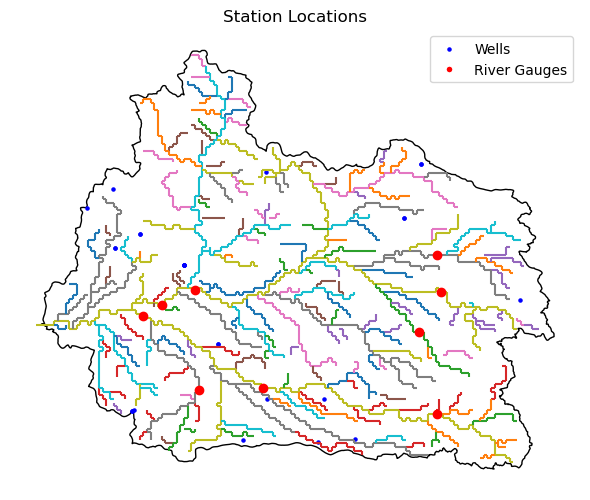
DHI, GEUS (2026). Integrated Hydrological Model of Skjern Å catchment: MIKE SHE model setup, inputs, outputs and observation data [Data set]. Zenodo. https://doi.org/10.5281/zenodo.18376532
MIKE21HD-SouthernNorthSea
Simplified MIKE 21 HD model of the Southern North Sea with ~8,000 elements (reduced from 150,000), covering the English Channel through the coasts of England, France, Belgium, the Netherlands, Germany, and Denmark for 2022–2023. Based on DHI’s work for the IJmuiden Ver offshore wind farm zone. Validated against in-situ measurements and satellite altimetry.
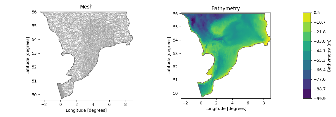
DHI. (2025). Hydrodynamic model of the Southern North Sea: MIKE21 model setup, outputs and observation data (Version v1) [Data set]. Zenodo. https://doi.org/10.5281/zenodo.14929387
MIKE21SW-SouthernNorthSea
Spectral wave model companion to the HD Southern North Sea case, covering the same domain for 2022–2023. The simplified mesh uses coarser inputs from ERA5 wind/pressure data and DHI’s global wave model for boundary conditions. Validated against CMEMS buoy measurements and satellite altimetry from multiple missions.
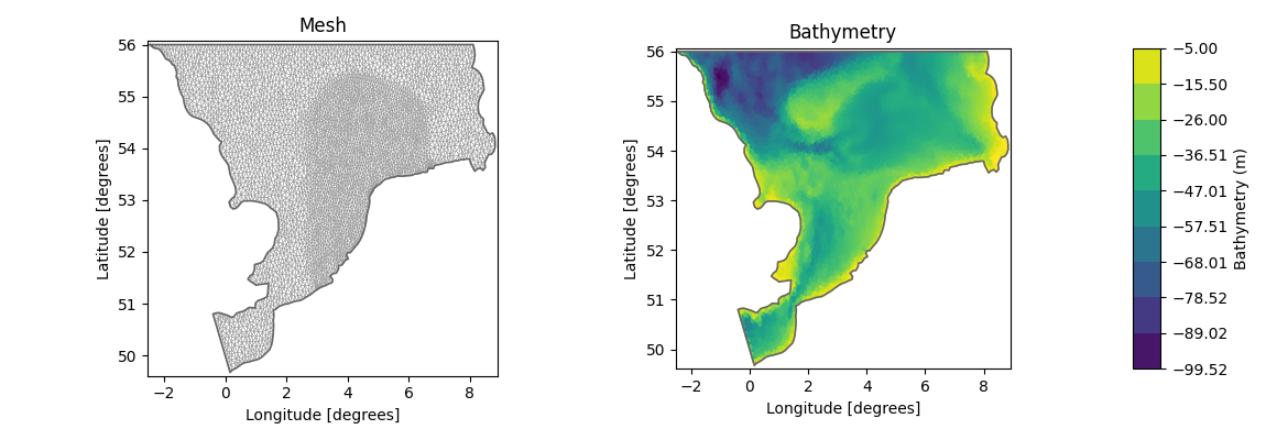
DHI. (2025). Spectral wave model of the Southern North Sea: MIKE21 SW model setup, outputs and observation data [Data set]. Zenodo. https://doi.org/10.5281/zenodo.17413569
MIKE21HD-ConceptionBay
MIKE 21 HD model of Conception Bay, Newfoundland, Canada with 8,474 elements covering ~900 km² for 2014–2022. Uses ERA5 reanalysis forcing and Canadian Hydrographic Service bathymetry. Validated against local measurement stations and satellite altimetry.
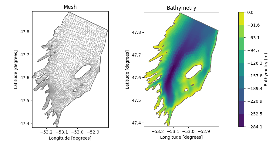
DHI. (2024). Hydrodynamic model of Conception Bay: MIKE21 model setup, outputs and observation data [Data set]. Zenodo. https://doi.org/10.5281/zenodo.14504931
MIKE21SW-SouthernNorthSea

DHI. (2025). Spectral wave model of the Southern North Sea: MIKE21 SW model setup, outputs and observation data (1.0) [Data set]. Zenodo. https://doi.org/10.5281/zenodo.17099653
MIKE21HD-Oresund
MIKE 21 HD model of the Øresund strait between Denmark and Sweden with 3,320 elements covering ~2,000 km² for 2014–2023. Uses ERA5 meteorological forcing and DHI’s DKBS model for boundary conditions. Validated against Copernicus and SMHI observations as well as satellite altimetry from six missions.
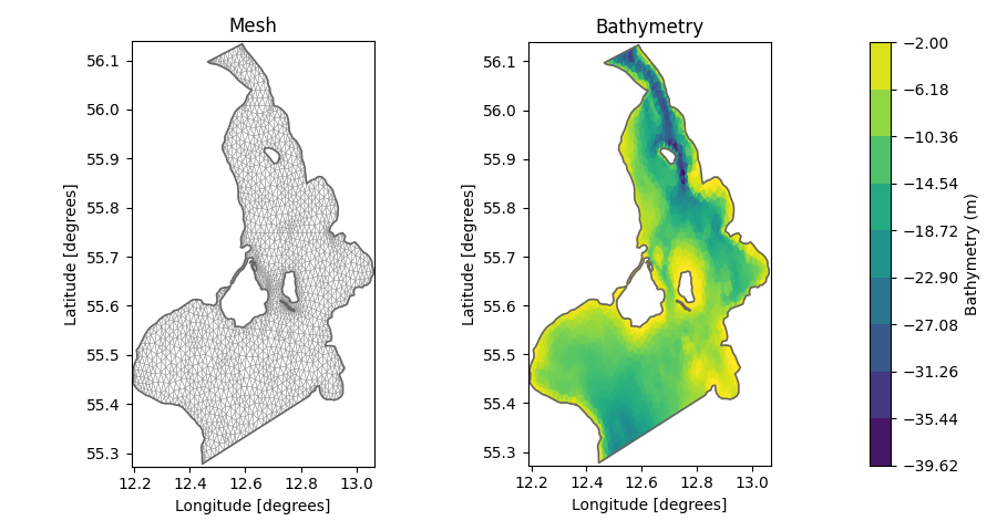
DHI. (2024). Hydrodynamic model of Øresund: MIKE21 model setup, outputs and observation data (1.0) [Data set]. Zenodo. https://doi.org/10.5281/zenodo.14160710
MIKE3HD-Oresund

MIKE 3 HD model of the Øresund strait between Denmark and Sweden. A 3D extension of the above MIKE 21 HD model of Oresund, with 3,320 elements covering ~2,000 km² for 2023–2025. Uses ERA5 meteorological forcing and DHI’s DKBS model for boundary conditions. Validated against Copernicus and SMHI observations as well as satellite altimetry.
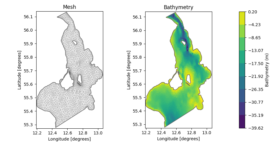
DHI. (2026). Hydrodynamic 3D model of the Øresund: MIKE3 model setup, outputs and observation data [Dataset]. Zenodo. https://doi.org/10.5281/zenodo.20284684
MIKE21HD-HamburgElbeEstuary
MIKE 21 HD model of the Hamburg–Elbe estuary, Germany, with ~8,000 elements covering ~70 km of river from Stadersand to the upstream weir at Geesthacht for 2020–2026. Features complex meandering morphology with tidal ranges of 5–6 m and intertidal drying. Driven by tidal water level fluctuations at Stadersand and river discharge at Geesthacht, based on bathymetry from the WSV DGM-W 2022 dataset. Validated against water level observations at gauging stations throughout the port of Hamburg.
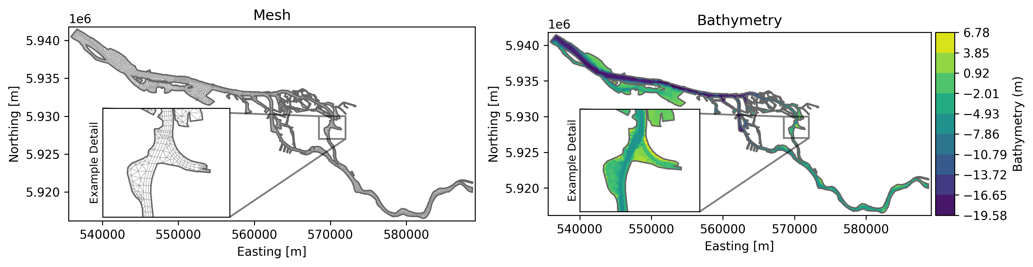
DHI. (2026). Hydrodynamic model of the Hamburg–Elbe estuary: MIKE21 model setup, outputs and observation data [Data set]. GitHub. https://github.com/DHI/WaterBench-MIKE21HD-HamburgElbeEstuary
TimeSeries-WWTPInflow
Approximately 15 months of hourly measurements of combined sewage inflow to an anonymized Danish wastewater treatment plant, accompanied by meteorological variables (precipitation, pressure, radiation, humidity, air and soil temperatures) from DMI. Intended for investigating data-driven inflow forecasting and benchmarking machine learning models.
DHI. (2025). Inflow to a Waste Water Treatment Plant: observations and processed data [Data set]. Zenodo. https://doi.org/10.5281/zenodo.15301164
Applications of WaterBench
The WaterBench cases are already applied in research dissemination through publications and conference presentations, university teaching, and MSc thesis projects. The list below provides an overview of some of these applications.
Publications
| Year | Reference |
|---|---|
| 2026 | Petersen, F.H., Mariegaard, J.S., Palmitessa, R., Engsig-Karup, A.P, Reduced-Order Surrogates for Forced Flexible Mesh Coastal-Ocean Models, Ocean Modelling, 2026, Volume 203, 102772 https://doi.org/10.1016/j.ocemod.2026.102772. |
Conference contributions
| Conference | Reference |
|---|---|
| EGU 2026 | Jessen, M. U., Mariegaard, J. S., and Petersen, F. H.: Measurement-Constrained Reduced-Order Surrogates for Flexible-Mesh Coastal Ocean Models, EGU General Assembly 2026, Vienna, Austria, 3–8 May 2026, EGU26-11847, https://doi.org/10.5194/egusphere-egu26-11847, 2026. [Poster] |
| EGU 2026 | Schäfer, F., Petersen, F. H., and Mariegaard, J. S.: Graph Neural Networks versus Reduced-Order Models for Surrogate-Based Coastal Forecasting on Unstructured Meshes, EGU General Assembly 2026, Vienna, Austria, 3–8 May 2026, EGU26-12542, https://doi.org/10.5194/egusphere-egu26-12542, 2026. [Poster] |
| EurIPS 2025 | Petersen, F.H., Engsig-Karup, A.P., Palmitessa, R., and Mariegaard, J.S.: Temporal stability in reduced order model prediction of sea states: A surrogate model case study. EurIPS 2025, Copenhagen, Denmark, 2-7 December 2025. [Poster]. [Abstract]. |
| AIS 2025 | Petersen, F. H., Engsig-Karup, A.P., Palmitessa, R., Mariegaard, J.S.: Accelerating Water Simulations with Reliable SurrogateModeling: Motivation and Early Directions. AI in Science Summit 2025, Copenhagen, Denmark, 3-4 November 2025. [Poster]. [Abstract (entry 4)]. |
Student Projects
| Year | University collaboration | Title | Type |
|---|---|---|---|
| 2026 | Technical University of Denmark | Enhancing flexible mesh machine learning surrogate for water models using observations | MSc. thesis |
| 2025 | Technical University of Denmark | Multiscale POD (mPOD): Decomposing Tidal Water Levels at Conception Bay | Exam project in course. [Poster] |
| 2025 | Chalmers University of Technology | A Surrogate Model for Accelerating Physics-Based Models | MSc. thesis |
Data providers
Large-scale open data providers relevant to water, ocean, atmosphere, and geoscience modelling:
| Provider | Description |
|---|---|
| Copernicus Marine Service | Ocean observations, reanalyses, and forecasts for the global ocean and European seas. |
| Copernicus Climate Data Store | ERA5 reanalysis, seasonal forecasts, climate projections, and satellite-derived climate variables. |
| NOAA Open Data | US weather, ocean, and climate data including tides, currents, bathymetry, and atmospheric observations. |
| dynamical.org | Easy-access catalog of archived weather datasets and forecasts in analysis-ready formats. |
| EMODnet | European marine observation data covering bathymetry, geology, physics, chemistry, and biology. |
| USGS Water Data | Real-time and historical streamflow, groundwater, and water quality data for the United States. |
| USGS Water Mission Area Catalog | Integrated datasets and tools from the USGS Water Mission Area for water-related research. |
| World Ocean Database (NOAA) | World’s largest collection of uniformly formatted, quality-controlled ocean profile data from the 1770s to present. |
| OpenET | Open-source evapotranspiration data for water management across the western United States. |
| UC Davis Hydrology Datasets | Curated guide to hydrological datasets and data repositories for research. |